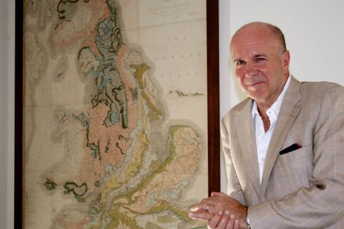
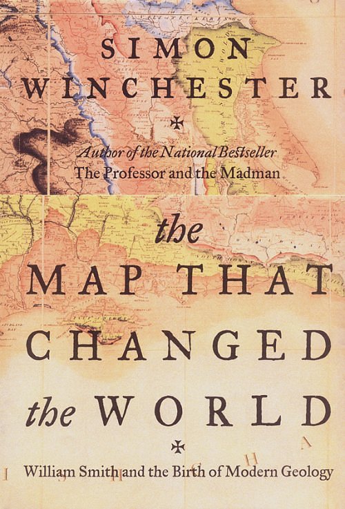
Simon Winchester — The Map That Changed the World: William Smith and the Birth of Modern Geology — Videos
William Smith’s map
Strata Smith: The Man & The Map
William Smith Interactive Map Viewer
William Smith Interactive Map Website
http://www.strata-smith.com./
Audio Book Review: The Map That Changed the World: William Smith and the Birth of Modern Geology …
William Smith (geologist)
| William Smith | |
|---|---|

William Smith
|
|
| Born | 23 March 1769 Churchill, Oxfordshire |
| Died | 28 August 1839 (aged 70) |
| Nationality | English |
| Fields | Geology |
| Known for | Geological map |
| Notable awards | Wollaston Medal (1831) |
William ‘Strata’ Smith (23 March 1769 – 28 August 1839) was an English geologist, credited with creating the first nationwide geological map. He is known as the “Father of English Geology” for collating the geological history of England and Wales into a single record, although recognition was very slow in coming. At the time his map was first published he was overlooked by the scientific community; his relatively humble education and family connections preventing him from mixing easily in learned society. Consequently his work was plagiarised; financially ruined, he spent time in debtors’ prison. It was only much later in his life that Smith received recognition for his accomplishments.
§Early life
Smith was born in the village of Churchill, Oxfordshire, the son of blacksmith John Smith, himself scion of a respectable farming family. His father died when Smith was just eight years old, and he was then raised by his uncle. In 1787, he found work as an assistant for Edward Webb of Stow-on-the-Wold, Gloucestershire, a surveyor. He was quick to learn, and soon became proficient at the trade. In 1791, he travelled to Somerset to make a valuation survey of the Sutton Court estate, and building on earlier work in the same area by John Strachey.[1] He stayed in the area for the next eight years, working first for Webb and later for the Somersetshire Coal Canal Company, living at Rugborne Farm in High Littleton.
Smith described his experiences when living in High Littleton and Bath as follows:
I resided from 1791-1795 in a part of the large old manor house belonging to Lady JONES called Rugburn in High Littleton. It was then occupied by a farmer Cornelius HARRIS, who lodged and boarded me for half a guinea a week and kept my horse for half a crown a week. I have often said that in one respect my residence was the most singular, it being nearer to three cities than any other place in Britain: it is 10 miles from Bath, 10 from Bristol and 12 from Wells. What is called the lower road from Bath to Wells goes through High Littleton but Rugburn old house is a quarter of a mile east of the village and about half way between it and Mearns coal pit. It is a large quadrangular house, I believe with a double M roof; several of the windows used to be darkened filled up. There was a square walled court in front with entrance gates between brick pillars on top of a flight of stone steps and on each side of the gates facing the south was a niche in the wall, where I used to sit and study. On the one side of the court was a row of lime trees, which screened it from the farmyard and the east wind, and on the other side was a large walled garden, and over the road of approach there was an avenue of fine elms all across a large piece of pasture. This had been the coach road when the house was occupied, as I understand, by a Major Capt. John BRITTON, who, according to the account of the old farmer, was said to have ruined himself by working the coal upon his own estate BRITTON’s half brother, William JONES of Stowey, baled [sic] him out with a loan of £1,200, in return for which BRITTON left JONES his High Littleton estates and lordship of the manor on his death in 1742. I collected much information from the old colliers respecting the coal, ancient collieries, faults re which I must herein omit; but I must be rather particular in describing the house, through it’s [sic] relation to the now extensively known science of geology; for, as some of my pupils and friends have called the vicinity of Bath the cradle of geology. I now inform them that RUGBURN WAS IT’S [sic] BIRTHPLACE.[2]
§Life’s work
Smith worked at one of the estate’s older mines, the Mearns Pit at High Littleton, part of the Somerset coalfield and the Somerset Coal Canal.[3] As he observed the rock layers (or strata) at the pit, he realised that they were arranged in a predictable pattern and that the various strata could always be found in the same relative positions. Additionally, each particular stratum could be identified by the fossils it contained, and the same succession offossil groups from older to younger rocks could be found in many parts of England. Furthermore, he noticed an easterly dip of the beds of rock—low near the surface (about three degrees), then higher after the Triassic rocks. This gave Smith a testable hypothesis, which he termed The Principle of Faunal Succession, and he began his search to determine if the relationships between the strata and their characteristics were consistent throughout the country.[4] During subsequent travels, first as a surveyor (appointed by noted engineer John Rennie) for the canal company until 1799 when he was dismissed, and later, he was continually taking samples and mapping the locations of the various strata, and displaying the vertical extent of the strata, and drawing cross-sections and tables of what he saw. This would earn him the name “Strata Smith”.[5] As a natural consequence, Smith amassed a large and valuable collection of fossils of the strata he had examined himself from exposures in canals, road and railway cuttings, quarries and escarpments across the country. He also developed methods for the identification of deposits of Fuller’s earth to the south of Bath.[6]
Engraving from William Smith’s 1815 monograph on identifying strata by fossils
He published his findings with many pictures from his fossil collection, enabling others to investigate their distribution and test his theories. His collection is especially good on Jurassicfossils he collected from the Cornbrash, Kimmeridge clay, Oxford clay, Oolitic limestone and other horizons in the sequence. They included many types of brachiopods, ammonites andmolluscs characteristic of the shallow seas in which they were deposited. Some of the names he coined (like Cornbrash) are still used today for this formation.
§Publication and disappointmen
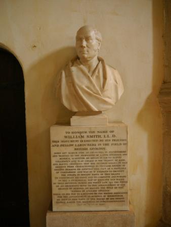
Bust of William Smith, in the Oxford University Museum of Natural History
In 1799 Smith produced the first large scale geologic map of the area around Bath, Somerset. Previously, he only knew how to draw the vertical extent of the rocks, but not how to display themhorizontally. However, in the Somerset County Agricultural Society, he found a map showing the types of soils and vegetation around Bath and their geographical extent. Importantly, the differing types were coloured. Using this technique, Smith could draw a geological map from his observations showing the outcrops of the rocks. He took a few rock types, each with its own colour. Then he estimated the boundaries of each of the outcrops of rock, filled them in with colour and ended up with a crude geological map.
In 1801, he drew a rough sketch of what would become “The Map that Changed the World” (which inspired the book of that name). Smith travelled extensively across Britain working as amineral surveyor allowing him to meet prominent people such as Thomas Coke, 1st Earl of Leicester, and the Duke of Bedford.[7]

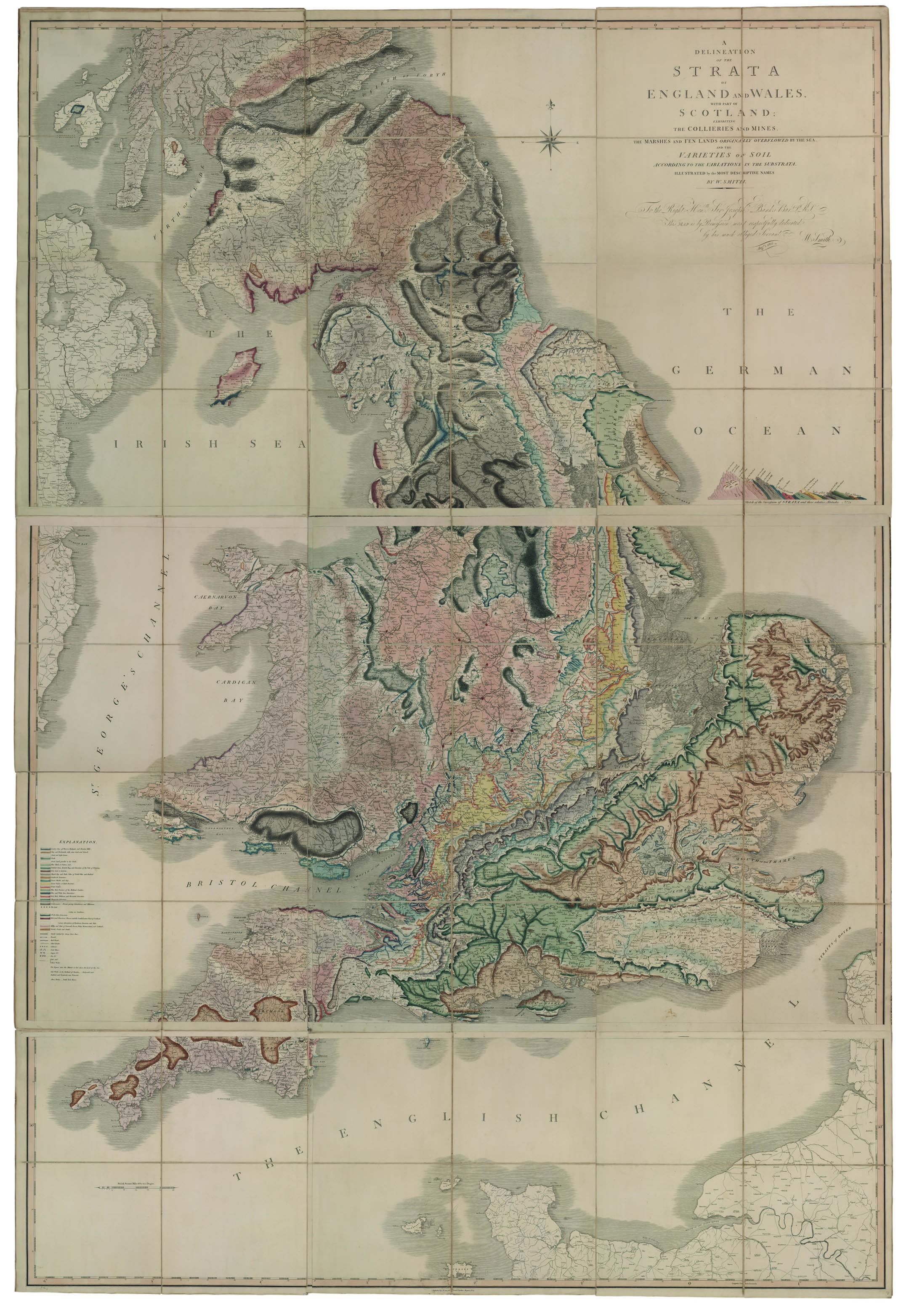
Smith’s famous 1815 geological map of part of Great Britain
In 1815 he published the first geological map of Britain. It covered the whole of England and Wales, and parts of Scotland. While this was not the world’s first geological map (a map of the United States by William Maclure was published six years earlier), Smith’s was the first geological map covering such a large area.[8][9][10] Conventional symbols were used to mark canals, tunnels, tramways and roads, collieries, lead, copper and tin mines, together with salt and alum works. The various geological types were indicated by different colours, applied by hand. Nevertheless, the map is remarkably similar to modern geological maps of England. He published his Delineation of the Strata of England in the same year.[11] In another of his books Strata Identified by Organized Fossils (London 1816-1819) he recognised that strata contained distinct fossil assemblages which could be used to match rocks across regions.[12]
In 1817 he drew a remarkable geological section from Snowdon to London. Unfortunately, his maps were soon plagiarised by the Geological Society of London and sold for prices lower than he was asking. He went into debt and finally became bankrupt.
On 31 August 1819 Smith was released from King’s Bench Prison in London, a debtor’s prison. He returned to his home of fourteen years at 15 Buckingham Street to find a bailiff at the door and his home and property seized. Smith then worked as an itinerant surveyor for many years until one of his employers, Sir John Johnstone, recognised him and took steps to gain for him the respect he deserved. Between 1824 and 1826 he lived and worked in Scarborough, and was responsible for the building of the Rotunda, a geological museum devoted to the Yorkshire coast. The Rotunda was re-opened as ‘Rotunda – The William Smith Museum of Geology’, on 9 May 2008 by Lord Oxburgh; however, the Prince of Wales visited the Rotunda as early as 14 September 2007 to view the progress of the refurbishment of this listed building.
§Later recognition

William Smith’s Grave
It was not until February 1831 that the Geological Society of London conferred on Smith the first Wollaston Medal in recognition of his achievement.[13] It was on this occasion that the President, Adam Sedgwick, referred to Smith as “the Father of English Geology”. Smith travelled to Dublin with the British Association in 1835, and there unexpectedly received an honorary Doctorate of Laws (LL.D.) from Trinity College. In 1838 he was appointed as one of the commissioners to select building-stone for the new Palace of Westminster. He died inNorthampton, and is buried a few feet from the west tower of St Peter’s Church, Marefair. The inscription on the grave is badly worn but the name “William Smith” can just be seen. Subsequent modern geological maps have been based on Smith’s original work, of which several copies have survived[14] including one which has been put on display at the Geological Society of London.
§Legacy

William Smith’s fossil collection that helped him produce the first geological map, on display in the British Museum.
- The first geological map of Britain, much copied in his time, and the basis for all others.
- Geological Surveys around the world owe a debt to his work.
- His nephew John Phillips lived during his youth with William Smith and was his apprentice. John Phillips became a major figure in 19th century geology and paleontology—among other things he’s credited as first to specify most of the table of geologic eras that is used today (1841).
- A crater on Mars is named after him. (see List of craters on Mars: O-Z#S)
- The Geological Society of London presents an annual lecture in his honour.
- In 2005, a William Smith ‘facsimile’ was created at the Natural History Museum as a notable gallery character to patrol its displays, among other luminaries such as Carl Linnaeus, Mary Anning, and Dorothea Bate.[15]
- His work was an important foundation for the work of Charles Darwin.
§See also
§References
- Jump up^ “Smith’s other debt”. Geoscientist 17.7 July 2007. The Geological Society. Retrieved 13 August 2008.[dead link]
- Jump up^ “William SMITH”. Michael L. Browning 2005. Highlittleton Parich Council. Retrieved 28 October 2009.
- Jump up^ “William Smith 1769 -1839 “The Father of English Geology””. Bath Royal Literary & Scientific Institution. Retrieved 23 February 2013.
- Jump up^ “William Smith (1769-1839)”. University of California Museum of Paleontology. Retrieved 23 February 2013.
- Jump up^ “William Smith”. Natural History Museum. Retrieved 23 February 2013.
- Jump up^ Macmillen, Neil (2009). A history of the Fuller’s Earth mining industry around Bath. Lydney: Lightmoor Press. p. 9. ISBN 978-1-899889-32-7.
- Jump up^ Phillips, John (1844). Memoirs of William Smith (First ed.). London: John Murray. p. 54. Retrieved 13 March 2015.
- Jump up^ “William Smith’s Geological Map of England”. Earth Observatory. NASA. Retrieved 23 February 2013.
- Jump up^ 1911 Encyclopedia Britannica
- Jump up^ Page 39 in Greene, J.C. and Burke, J.G. (1978) The Science of Minerals in the Age of Jefferson. Transactions of the American Philosophical Society, New Series, Vol. 68, No. 4, pp. 1–113
- Jump up^ “William “Strata” Smith (1769-1838)”. HoG Biographies. Retrieved 23 February 2013.
- Jump up^ Palmer, Douglas (2005). Earth Time: Exploring the Deep Past from Victorian England to the Grand Canyon. Wiley. ISBN 978-0470022214.
- Jump up^ “November 1826 – June 1833”. Proceedings of the Geological Society of London I: 271. 1834. Retrieved 13 March 2015.
- Jump up^ Eyles, V.A; Eyles, Joan M. (1938). “On the different issues of the first geological map of England and Wales”. Annals of Science 3 (2): 190–212. doi:10.1080/00033793800200871. Retrieved 30 June 2014.
- Jump up^ Review by Miles Russell of Discovering Dorothea by Karolyn Shindler at ucl.ac.uk (accessed 23 November 2007)
§Other sources
- John L. Morton, Strata (New Edition, 2004), Horsham: Brocken Spectre Publishing. ISBN 0-9546829-1-2
- Simon Winchester, The Map That Changed the World: William Smith and the Birth of Modern Geology, (2001), New York: HarperCollins, ISBN 0-14-028039-1
- John Phillips, Memoirs of William Smith (1844, republished with additional material by Hugh Torrens, 2003 ISBN 0-9544941-0-5).
- Hugh Torrens, “In Commemoration of the 150th anniversary of the death of William Smith (1769-1839)“
- William Smith’s Private Papers, Oxford University
- A. Taylor, “A History of the Taylor Family”, (1986), Privately Published.
http://en.wikipedia.org/wiki/William_Smith_%28geologist%29
| Wikimedia Commons has media related to William Smith (geologist). |

Leave a comment